

ಟ್ವೀಟ್ಗಳು
- ಟ್ವೀಟ್ಗಳು, ಪ್ರಸ್ತುತ ಪುಟ.
- ಟ್ವೀಟ್ಗಳು & ಪ್ರತಿಕ್ರಿಯೆಗಳು
- ಮಾಧ್ಯಮ
ನೀವು @USGS ಅವರನ್ನು ತಡೆಹಿಡಿದಿರುವಿರಿ
ಈ ಟ್ವೀಟ್ಗಳನ್ನು ವೀಕ್ಷಿಸಲು ನೀವು ಖಚಿತವಾಗಿ ಬಯಸುವಿರಾ? ಟ್ವೀಟ್ ವೀಕ್ಷಣೆಯು @USGS ಅವರ ತಡೆತೆರವುಗೊಳಿಸುವುದಿಲ್ಲ
-
[FAQ] Why are coral reefs in peril and what is being done to protect them? https://www.usgs.gov/faqs/why-are-coral-reefs-peril-and-what-being-done-protect-them-0?qt-news_science_products=0#qt-news_science_products …
#wildlifehealthpic.twitter.com/Eje8FcR1ZS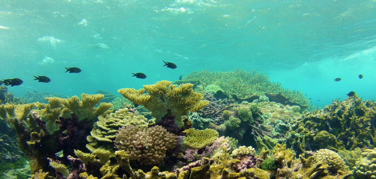 ಧನ್ಯವಾದಗಳು. Twitter ಇದನ್ನು ನಿಮ್ಮ ಕಾಲರೇಖೆಯನ್ನು ಉತ್ತಮಗೊಳಿಸಲು ಬಳಸುತ್ತದೆ. ರದ್ದುಗೊಳಿಸು
 -
This handy poster illustrates the different types of geologic hazards associated with
#volcanoes. Download for free here - https://pubs.usgs.gov/gip/64/#MagmaMondaypic.twitter.com/E7PjQpTRWo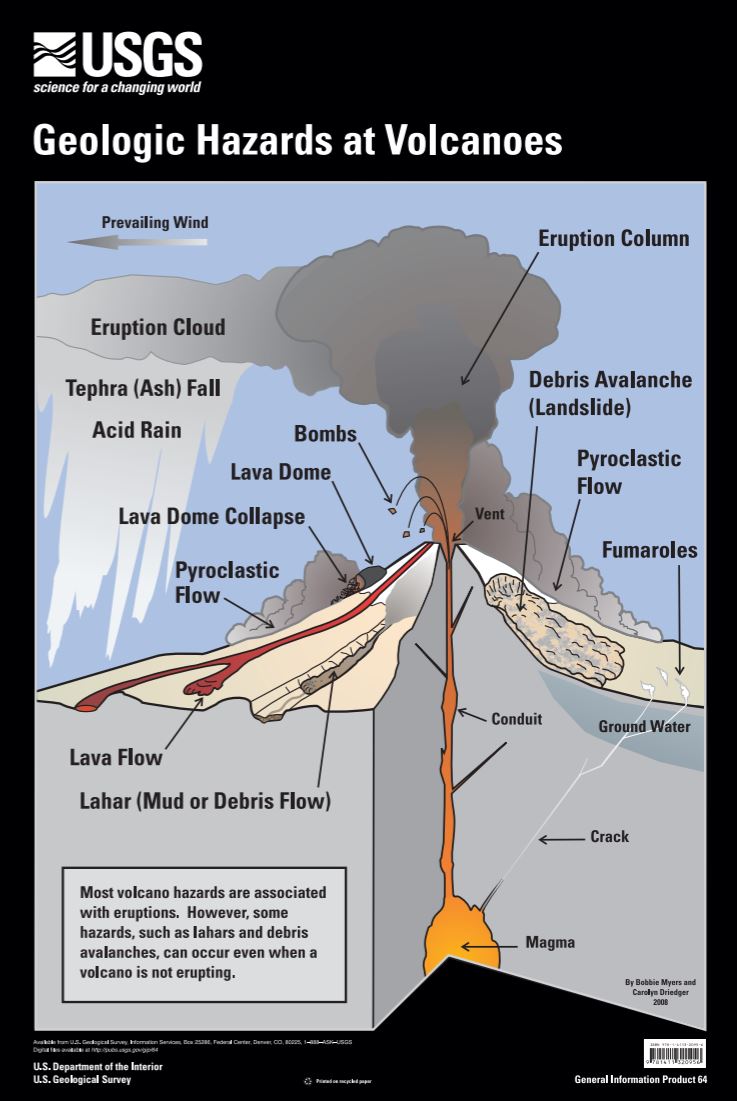 ಧನ್ಯವಾದಗಳು. Twitter ಇದನ್ನು ನಿಮ್ಮ ಕಾಲರೇಖೆಯನ್ನು ಉತ್ತಮಗೊಳಿಸಲು ಬಳಸುತ್ತದೆ. ರದ್ದುಗೊಳಿಸು
 -
USGS ಅವರು ಮರುಟ್ವೀಟಿಸಿದ್ದಾರೆಧನ್ಯವಾದಗಳು. Twitter ಇದನ್ನು ನಿಮ್ಮ ಕಾಲರೇಖೆಯನ್ನು ಉತ್ತಮಗೊಳಿಸಲು ಬಳಸುತ್ತದೆ. ರದ್ದುಗೊಳಿಸು
-
Remembering the Christmas Flood of 1964 when 200,000 sq mi of land in OR, ID, CA, WA, & NV endured severe
#flooding https://or.water.usgs.gov/flood64/ pic.twitter.com/07X8oMbh2f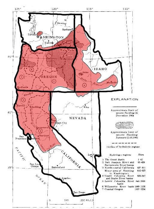 ಧನ್ಯವಾದಗಳು. Twitter ಇದನ್ನು ನಿಮ್ಮ ಕಾಲರೇಖೆಯನ್ನು ಉತ್ತಮಗೊಳಿಸಲು ಬಳಸುತ್ತದೆ. ರದ್ದುಗೊಳಿಸು
 -
What is the meaning of the karat mark on gold jewelry? Find the answer (& more mineral fun facts) here: https://minerals.usgs.gov/west/morefun.htm …
#mineralmonday Pic: Bureau of Minespic.twitter.com/zCAz55M8aO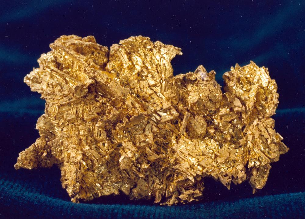 ಧನ್ಯವಾದಗಳು. Twitter ಇದನ್ನು ನಿಮ್ಮ ಕಾಲರೇಖೆಯನ್ನು ಉತ್ತಮಗೊಳಿಸಲು ಬಳಸುತ್ತದೆ. ರದ್ದುಗೊಳಿಸು
 -
Happy Statehood Day
#Indiana! Download a#landsat state mosaic of IN (and the rest of the US) here - https://eros.usgs.gov/imagegallery/landsat-state-mosaics …pic.twitter.com/2nq4W0IxTQ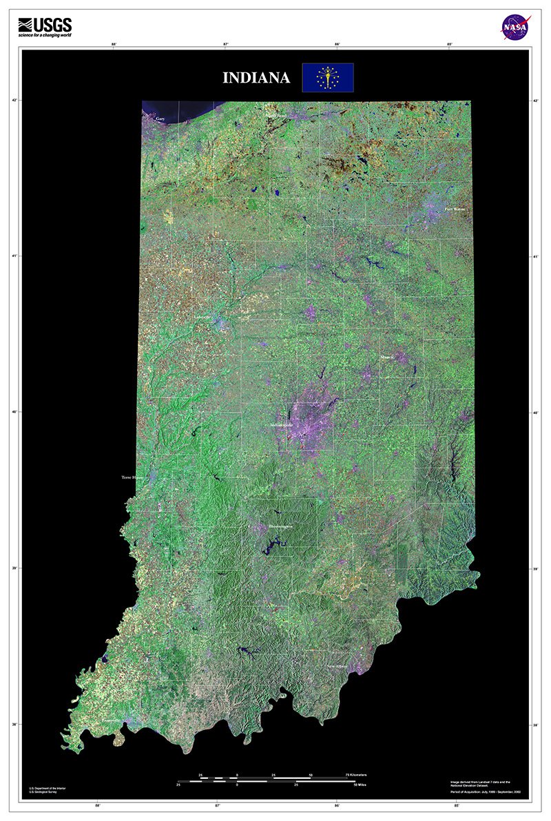 ಧನ್ಯವಾದಗಳು. Twitter ಇದನ್ನು ನಿಮ್ಮ ಕಾಲರೇಖೆಯನ್ನು ಉತ್ತಮಗೊಳಿಸಲು ಬಳಸುತ್ತದೆ. ರದ್ದುಗೊಳಿಸು
 -
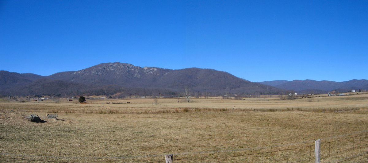
Get outdoors, breathe the fresh air & enjoy the beauty of our magnificent scenic resources https://pubs.usgs.gov/of/2000/of00-263/of00-263.pdf …pic.twitter.com/gzA25Q1L6f
 ಧನ್ಯವಾದಗಳು. Twitter ಇದನ್ನು ನಿಮ್ಮ ಕಾಲರೇಖೆಯನ್ನು ಉತ್ತಮಗೊಳಿಸಲು ಬಳಸುತ್ತದೆ. ರದ್ದುಗೊಳಿಸು
 -
[FAQ] Can I donate my fossil collection to the USGS? https://www.usgs.gov/faqs/can-i-donate-my-fossil-collection-usgs?qt-news_science_products=7#qt-news_science_products …
#FossilFridaypic.twitter.com/HK9fawgurU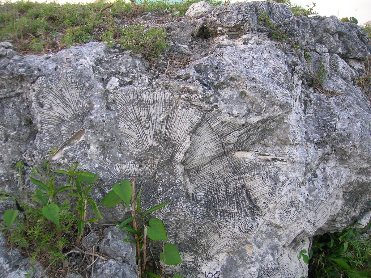 ಧನ್ಯವಾದಗಳು. Twitter ಇದನ್ನು ನಿಮ್ಮ ಕಾಲರೇಖೆಯನ್ನು ಉತ್ತಮಗೊಳಿಸಲು ಬಳಸುತ್ತದೆ. ರದ್ದುಗೊಳಿಸು
 -
#Geology101 What do the Appalachians, Scotland’s Highlands, and Morocco’s Atlas Mtns have in common? They all contain remnants of the ancient Central Pangaean Mtns, formed during the creation of the supercontinent Pangaea 335 million years agopic.twitter.com/Rxen9HxmMn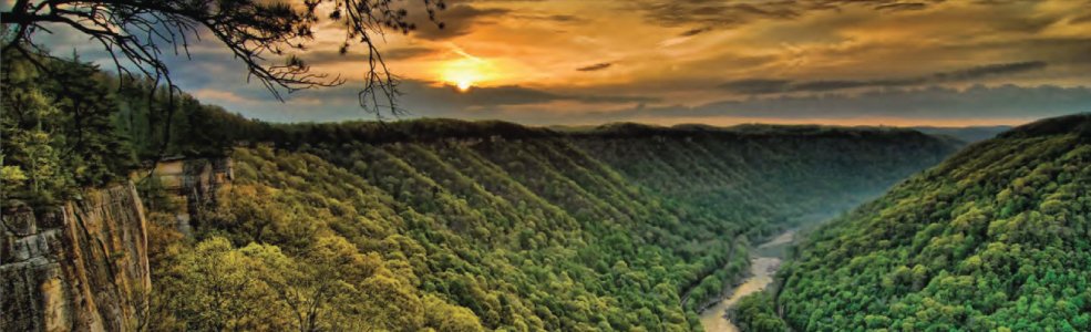 ಧನ್ಯವಾದಗಳು. Twitter ಇದನ್ನು ನಿಮ್ಮ ಕಾಲರೇಖೆಯನ್ನು ಉತ್ತಮಗೊಳಿಸಲು ಬಳಸುತ್ತದೆ. ರದ್ದುಗೊಳಿಸು
 -
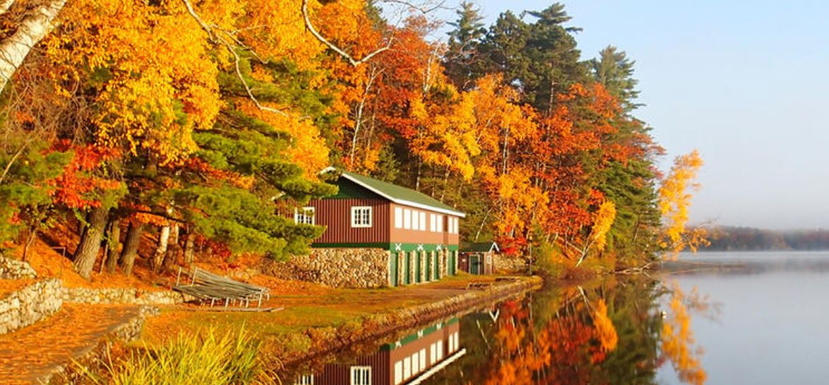
USGS ಅವರು ಮರುಟ್ವೀಟಿಸಿದ್ದಾರೆ
Gorgeous golden sunrise over a frozen lake at Voyageurs National Park
#Minnesotapic.twitter.com/T8AQnIaNq4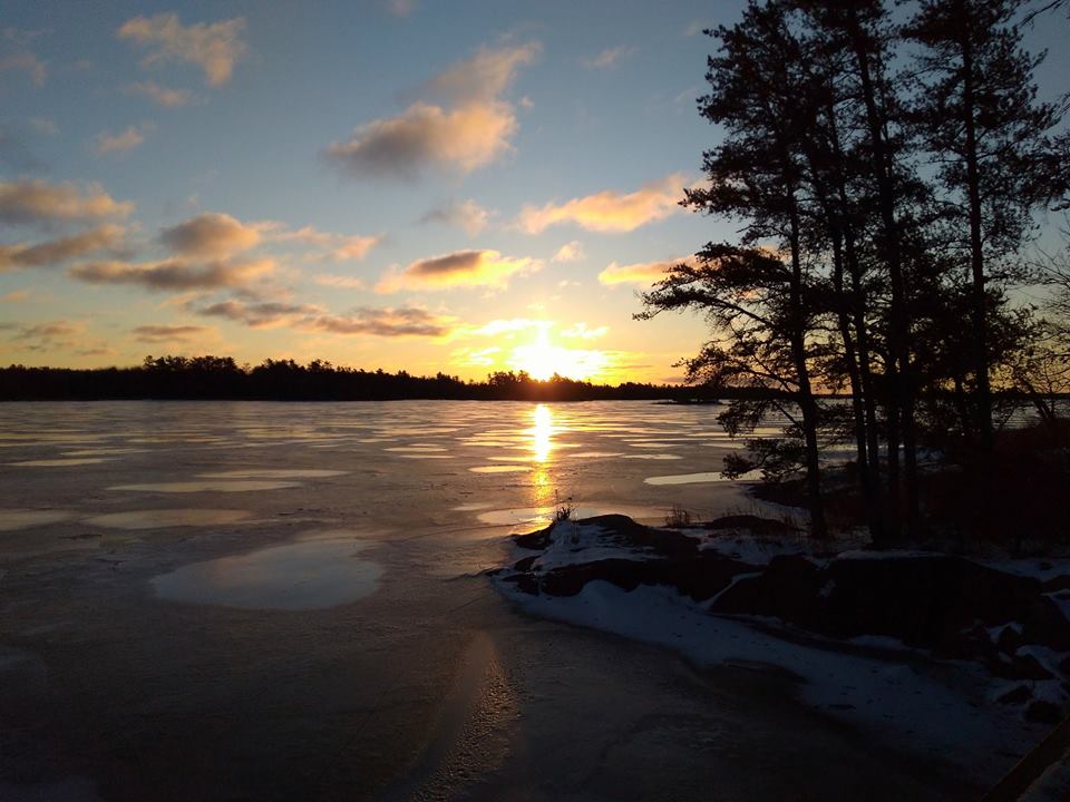 ಧನ್ಯವಾದಗಳು. Twitter ಇದನ್ನು ನಿಮ್ಮ ಕಾಲರೇಖೆಯನ್ನು ಉತ್ತಮಗೊಳಿಸಲು ಬಳಸುತ್ತದೆ. ರದ್ದುಗೊಳಿಸು
 -
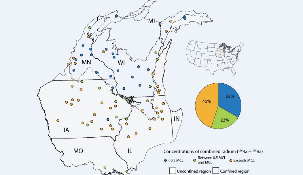
Untreated water from one of the nation’s key aquifers is known to have higher-than-typical levels of radium. A new study from the USGS sheds light on why: https://on.doi.gov/2jNsZqz pic.twitter.com/C9CmaSLdCb
 ಧನ್ಯವಾದಗಳು. Twitter ಇದನ್ನು ನಿಮ್ಮ ಕಾಲರೇಖೆಯನ್ನು ಉತ್ತಮಗೊಳಿಸಲು ಬಳಸುತ್ತದೆ. ರದ್ದುಗೊಳಿಸು
 -
Sharing isn’t always polite, judging by this
#EarthWord: http://go.usa.gov/xnN3s#wildlifedisease#wildlifehealth Photo Credit: Graham Hickling, Univ of TNpic.twitter.com/0nCyVhCarH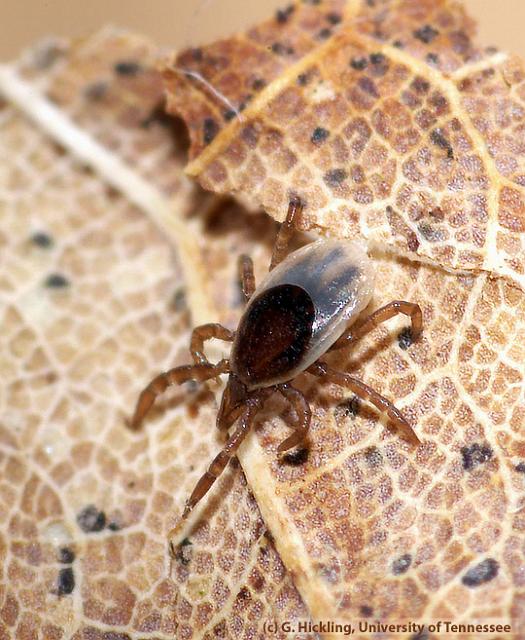 ಧನ್ಯವಾದಗಳು. Twitter ಇದನ್ನು ನಿಮ್ಮ ಕಾಲರೇಖೆಯನ್ನು ಉತ್ತಮಗೊಳಿಸಲು ಬಳಸುತ್ತದೆ. ರದ್ದುಗೊಳಿಸು
 -
[FAQ] What species of bats are affected by White-nose Syndrome?https://www.usgs.gov/faqs/what-species-bats-are-affected-white-nose-syndrome?qt-news_science_products=0#qt-news_science_products … Pic:NY DEC
#wildlifehealth#wildlifediseasepic.twitter.com/7ZT9jrU2fR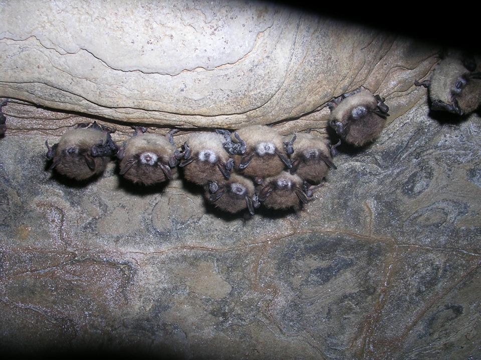 ಧನ್ಯವಾದಗಳು. Twitter ಇದನ್ನು ನಿಮ್ಮ ಕಾಲರೇಖೆಯನ್ನು ಉತ್ತಮಗೊಳಿಸಲು ಬಳಸುತ್ತದೆ. ರದ್ದುಗೊಳಿಸು
 -
Quality of the Nation’s Groundwater: Latest results from 4 regional aquifers available today. More: https://www.usgs.gov/news/quality-nation-s-groundwater-progress-a-national-survey …pic.twitter.com/DKzHRF4MwE
 ಧನ್ಯವಾದಗಳು. Twitter ಇದನ್ನು ನಿಮ್ಮ ಕಾಲರೇಖೆಯನ್ನು ಉತ್ತಮಗೊಳಿಸಲು ಬಳಸುತ್ತದೆ. ರದ್ದುಗೊಳಿಸು
 -
Very eerie, like the
#UpsideDown in@Stranger_Things but these lava trees are actually molds of tree trunks formed as lava flowed around them & cooled in '83 at#Kilauea#HIpic.twitter.com/A9mbR9vJV4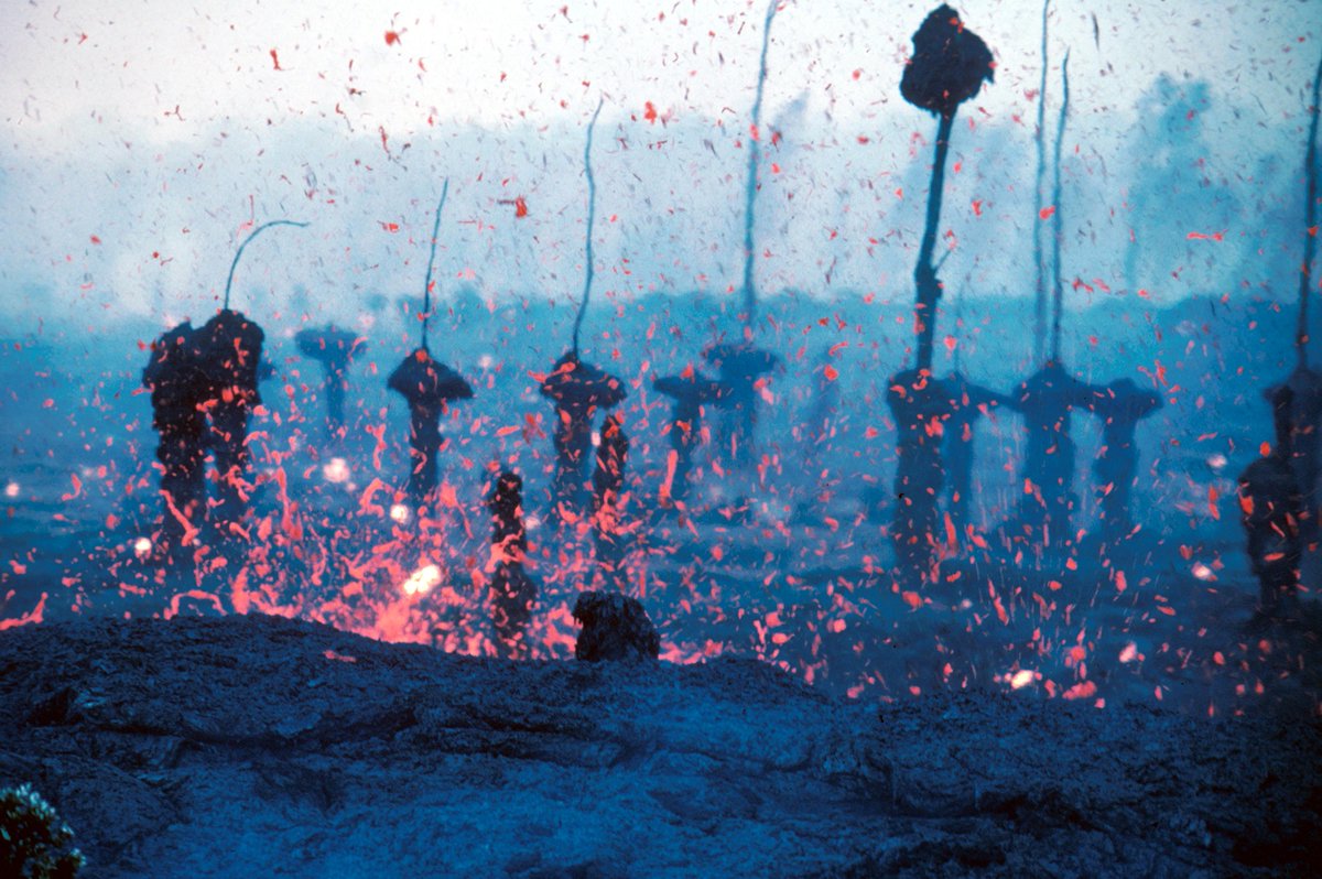 ಧನ್ಯವಾದಗಳು. Twitter ಇದನ್ನು ನಿಮ್ಮ ಕಾಲರೇಖೆಯನ್ನು ಉತ್ತಮಗೊಳಿಸಲು ಬಳಸುತ್ತದೆ. ರದ್ದುಗೊಳಿಸು
 -
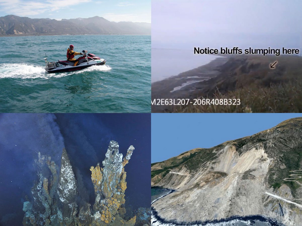
USGS ಅವರು ಮರುಟ್ವೀಟಿಸಿದ್ದಾರೆ
USGS Open House in Santa Cruz, CA on Saturday, December 9, 11 am to 4 pm. Talk to scientists and check out a dozen displays on coastal & offshore geology and biology. Details: https://marine.usgs.gov/news pic.twitter.com/cWP3zrMace
 ಧನ್ಯವಾದಗಳು. Twitter ಇದನ್ನು ನಿಮ್ಮ ಕಾಲರೇಖೆಯನ್ನು ಉತ್ತಮಗೊಳಿಸಲು ಬಳಸುತ್ತದೆ. ರದ್ದುಗೊಳಿಸು
 -
Portion of Puuloa, HI 7.5-minute map, 1953 of the Pearl Harbor area on Oahu, HI Use topoView to find other historical maps https://ngmdb.usgs.gov/topoview/
#PearlHarbor#tbtpic.twitter.com/eaxIUl8HFo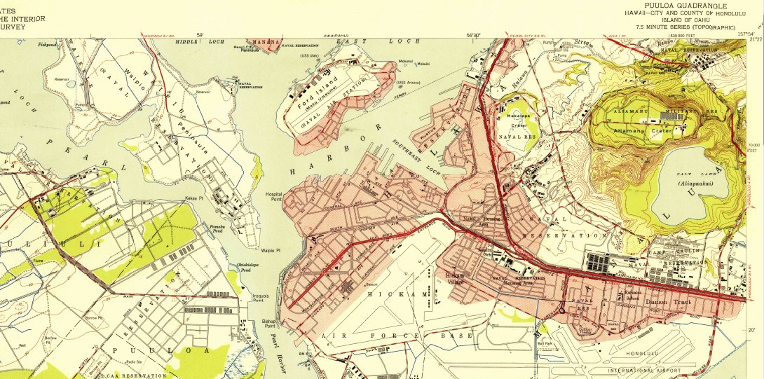 ಧನ್ಯವಾದಗಳು. Twitter ಇದನ್ನು ನಿಮ್ಮ ಕಾಲರೇಖೆಯನ್ನು ಉತ್ತಮಗೊಳಿಸಲು ಬಳಸುತ್ತದೆ. ರದ್ದುಗೊಳಿಸು
 -
On board
#Landsat 8 are two sensors that capture data about the Earth's surface. Landsat sees Earth through 11 spectral bands. Here is an explanation of the instruments that capture every pixel.pic.twitter.com/5EI2h9g3evಧನ್ಯವಾದಗಳು. Twitter ಇದನ್ನು ನಿಮ್ಮ ಕಾಲರೇಖೆಯನ್ನು ಉತ್ತಮಗೊಳಿಸಲು ಬಳಸುತ್ತದೆ. ರದ್ದುಗೊಳಿಸು -
A wet job for a
#WaterWednesday as this technician measures streamflow in northern Nevada. Lots of streamflow information is available here: https://waterwatch.usgs.gov/?id=ww_current pic.twitter.com/WoOTft1iFt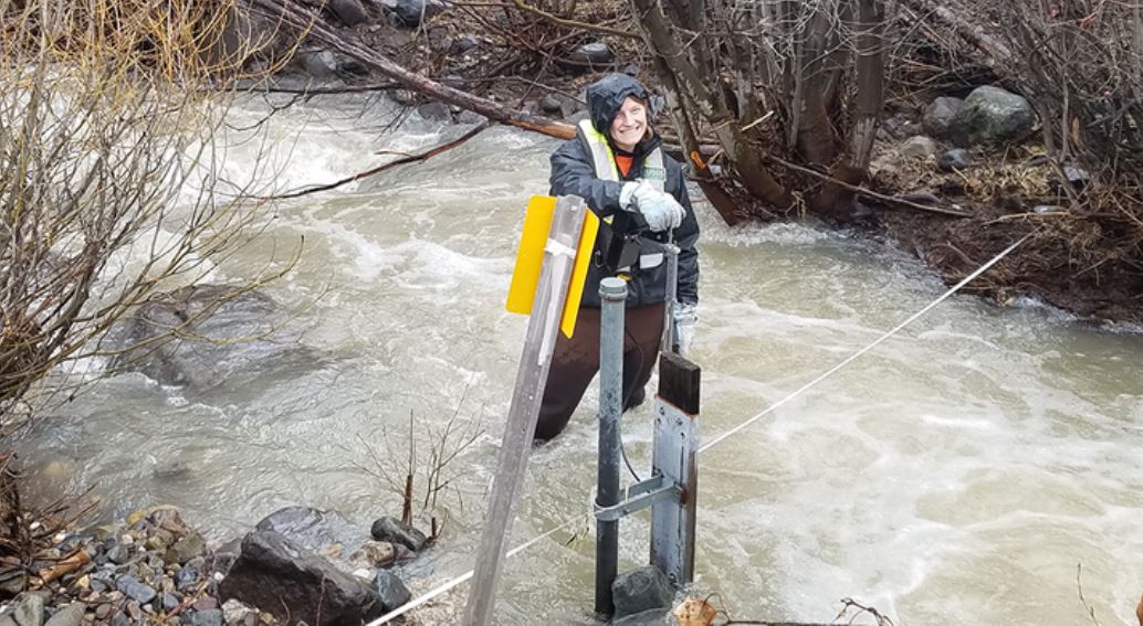 ಧನ್ಯವಾದಗಳು. Twitter ಇದನ್ನು ನಿಮ್ಮ ಕಾಲರೇಖೆಯನ್ನು ಉತ್ತಮಗೊಳಿಸಲು ಬಳಸುತ್ತದೆ. ರದ್ದುಗೊಳಿಸು
 -
Scientists Home in on Causes of High Radium Levels in Key Midwestern Aquifer https://www.usgs.gov/news/scientists-home-causes-high-radium-levels-key-midwestern-aquifer …pic.twitter.com/nSl67qz22P
 ಧನ್ಯವಾದಗಳು. Twitter ಇದನ್ನು ನಿಮ್ಮ ಕಾಲರೇಖೆಯನ್ನು ಉತ್ತಮಗೊಳಿಸಲು ಬಳಸುತ್ತದೆ. ರದ್ದುಗೊಳಿಸು


ಲೋಡಿಂಗ್ ಸಮಯ ಸ್ವಲ್ಪ ತೆಗೆದುಕೊಳ್ಳುತ್ತಿರುವಂತೆನಿಸುತ್ತದೆ.
Twitter ಸಾಮರ್ಥ್ಯ ಮೀರಿರಬಹುದು ಅಥವಾ ಕ್ಷಣಿಕವಾದ ತೊಂದರೆಯನ್ನು ಅನುಭವಿಸುತ್ತಿರಬಹುದು. ಮತ್ತೆ ಪ್ರಯತ್ನಿಸಿ ಅಥವಾ ಹೆಚ್ಚಿನ ಮಾಹಿತಿಗೆ Twitter ಸ್ಥಿತಿಗೆ ಭೇಟಿ ನೀಡಿ.