

ಟ್ವೀಟ್ಗಳು
- ಟ್ವೀಟ್ಗಳು
- ಟ್ವೀಟ್ಗಳು & ಪ್ರತಿಕ್ರಿಯೆಗಳು
- ಮಾಧ್ಯಮ
@wsoctv ತಡೆಹಿಡಿಯಲಾಗಿದೆ
ನೀವು ಖಚಿತವಾಗಿಯೂ ಈ ಟ್ವೀಟ್ಗಳನ್ನು ನೋಡಲು ಬಯಸುವಿರಾ? ಟ್ವೀಟ್ಗಳನ್ನು ನೋಡುವುದು @wsoctv ಅವರನ್ನು ತಡೆತೆರವುಗೊಳಿಸುವುದಿಲ್ಲ.
-
McMullen Creek running very high this morning! Most of
#CLTwx metro recording 1.5-2.5" via@StormWaterCM@wsoctv#NCWX#SCwx#Matthewpic.twitter.com/3IOpNHW429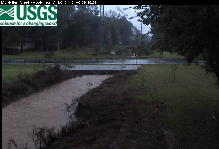
-
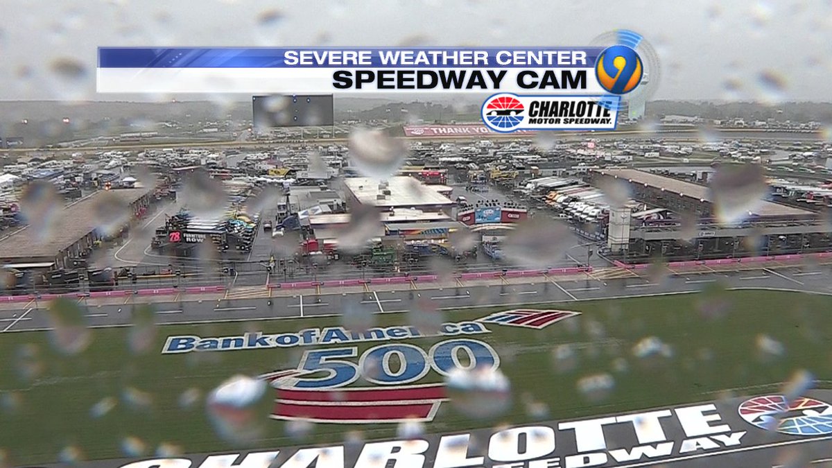
Soggy conditions at
@CLTMotorSpdwy this morning, but rain *DOES* look to clear for the#BofA500 this evening.#NASCAR@wsoctv#NCWX#Matthewpic.twitter.com/8mOOhaaOfH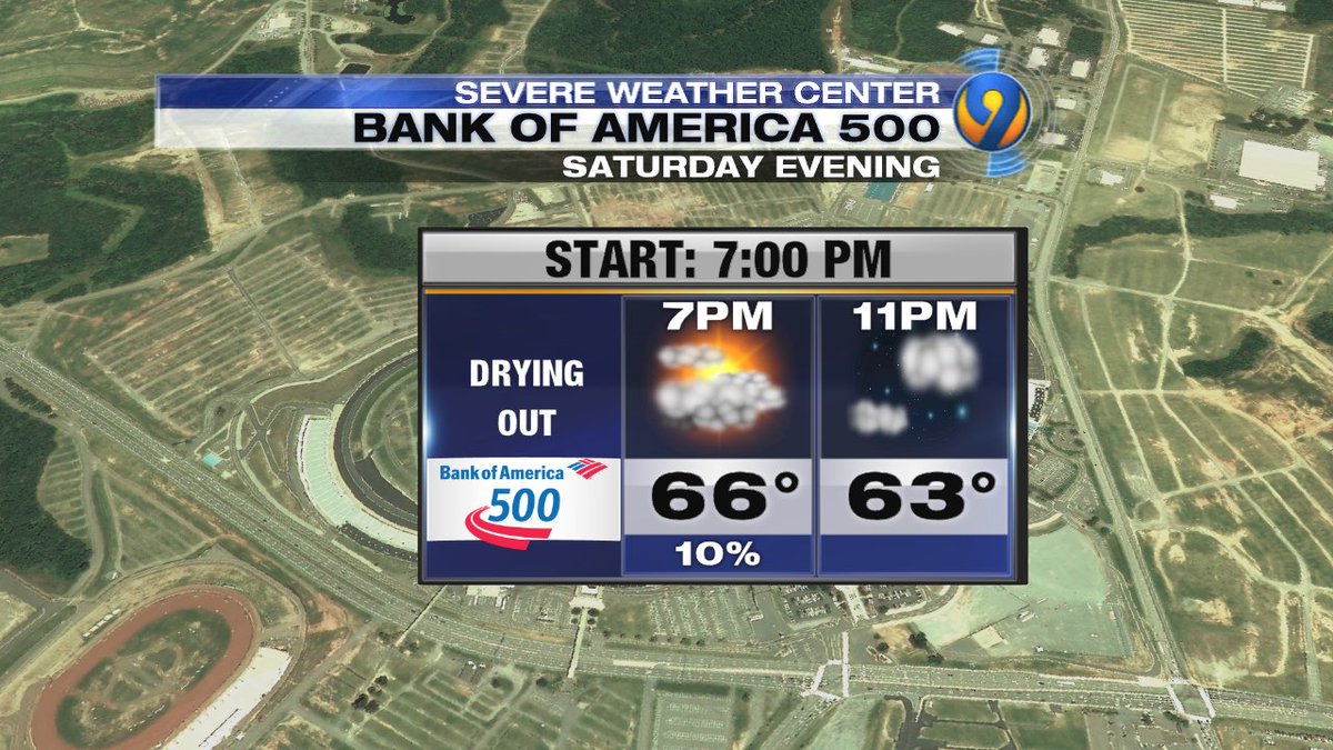
-
IF YOU LOSE POWER: Download our free
@wsoctv Weather app for flooding alerts and notifications.#NCWX#SCWX#Matthew http://wsoctvweatherapp.com pic.twitter.com/5M50faiOlS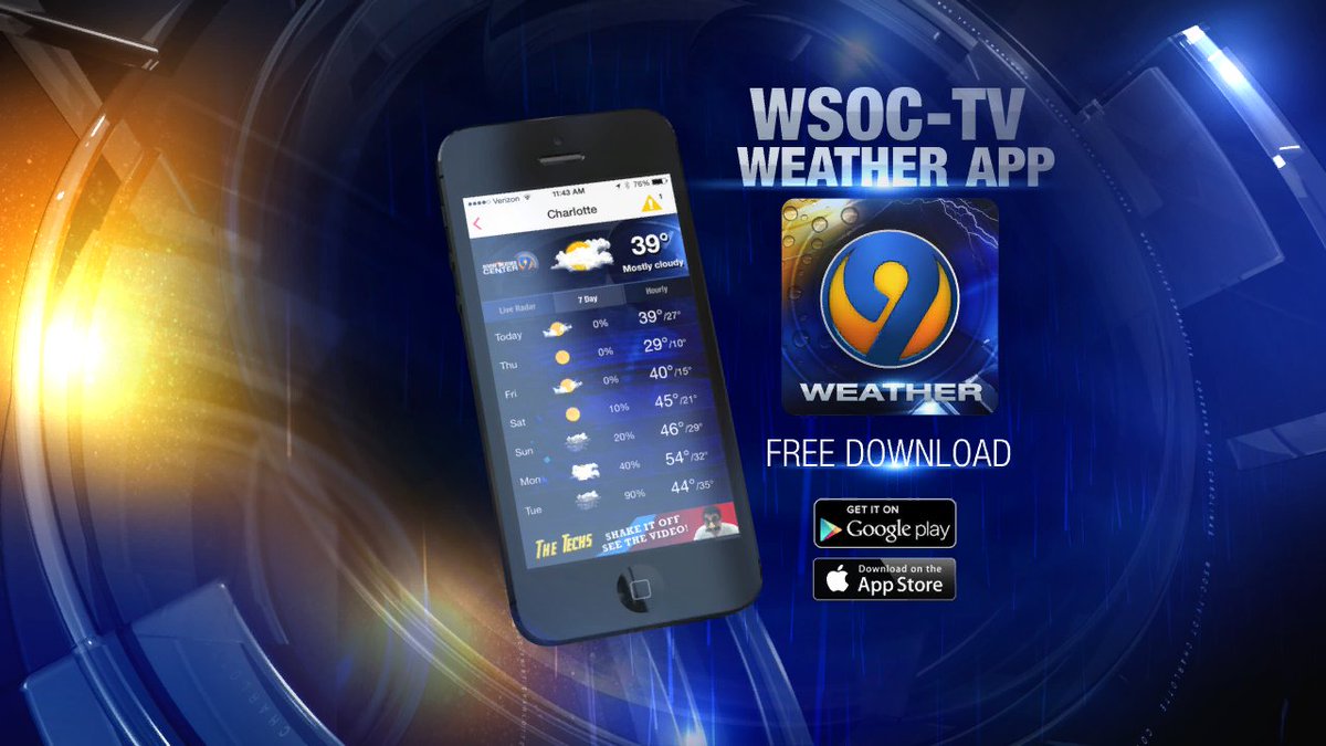
-
Rain adding up to 1.72" in Charlotte (
@CLTAirport) since Friday morning. How much rain have you received in your area?#Matthew@wsoctvpic.twitter.com/SDLlcy9mBj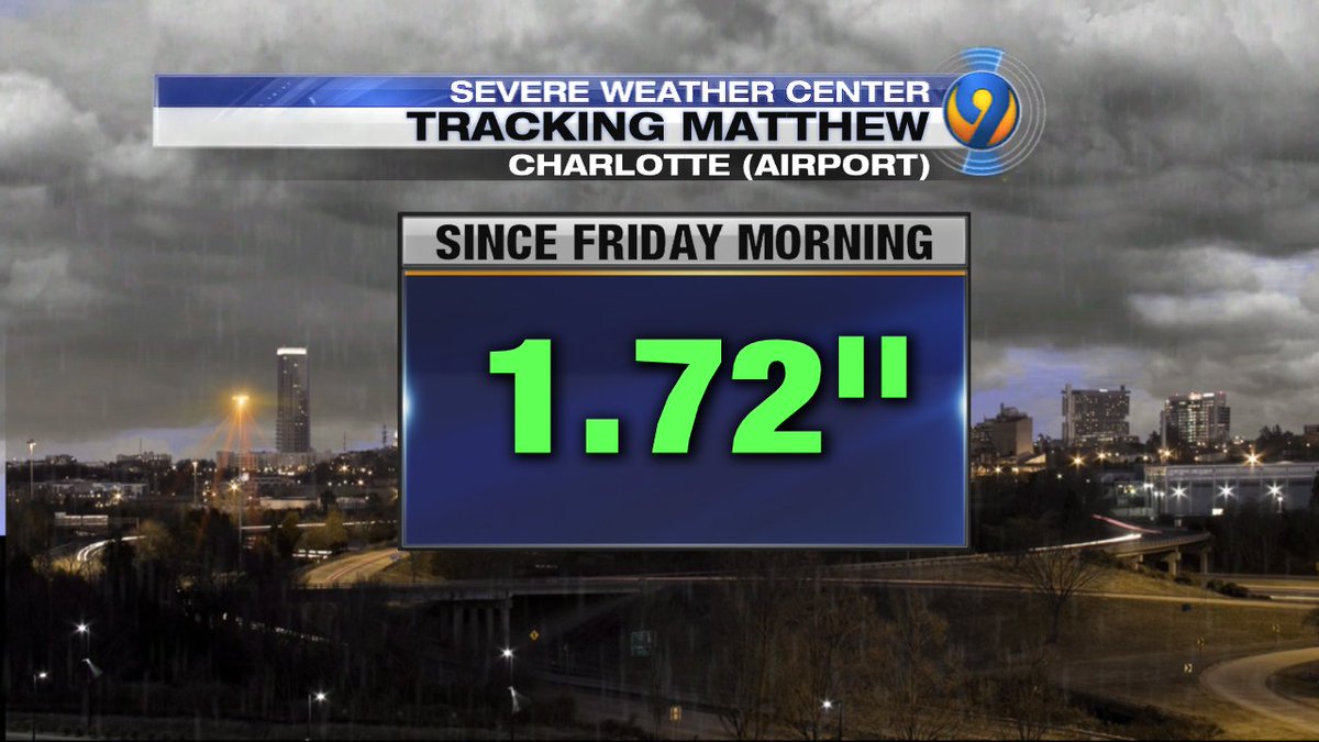
-
Here's a look at where
#HurricaneMatthew is now with northwestern edge touching Charlotte. INTERACTIVE RADAR: http://on.wsoctv.com/2djRG9O pic.twitter.com/CXEGhShou0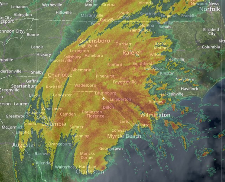
-
Were you here during Hurricane Floyd?
@PatMcCroryNC says#HurricaneMatthew could bring the worst rain we've seen since then@wsoctv -
We just got an update from
@PatMcCroryNC. 450+ in shelters in NC. Inland areas at risk of seeing heavy rain and possible flooding@wsoctv -
CHARLOTTE: Main concern -damaging wind (40+ mph) & heavy rain through the afternoon. Watch for tree damage & possible power outages
#Matthewpic.twitter.com/N2I7RszyjP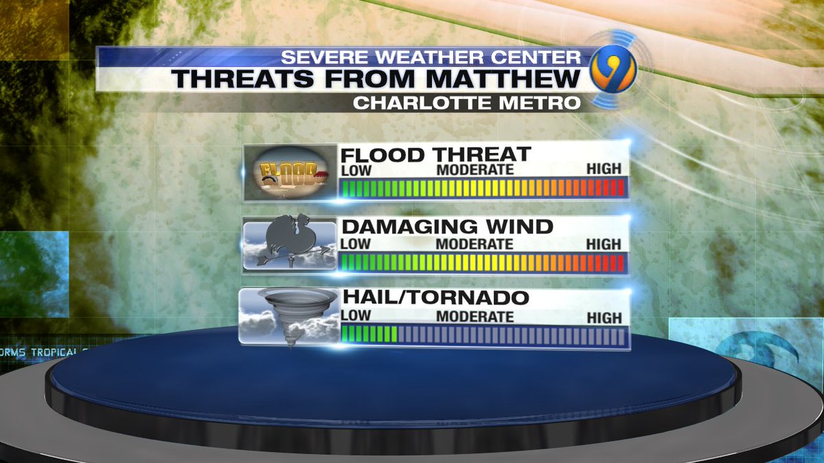
-
9:30a - wind gusts still up near 35-40 mph in Chesterfield Co. Watch for tree damage with ground so saturated!
#SCwx#NCwx#Matthew@wsoctvpic.twitter.com/yPKnQeBQF7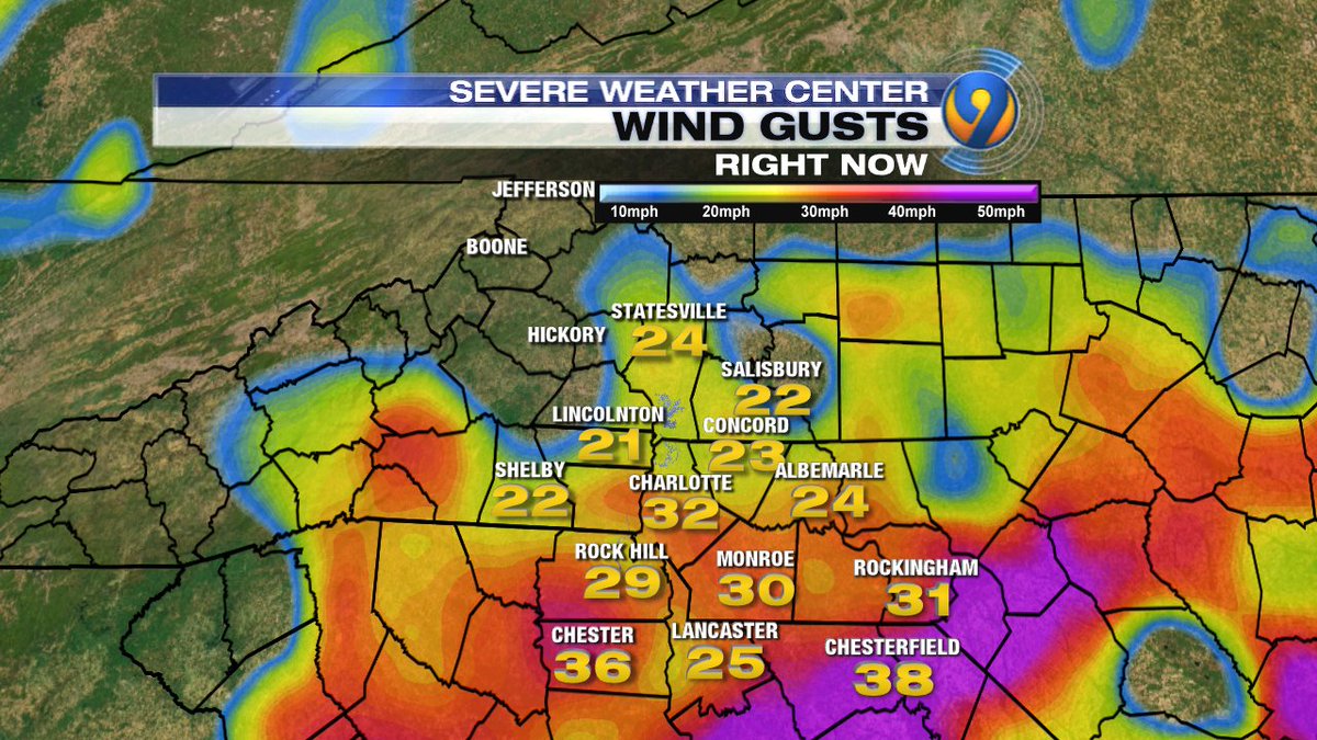
-
Flooding photo from Summerville, SC. This is BI-LO parking lot on Dorchester Rd.
#HurricaneMatthew http://on.wsoctv.com/2dmgSwl pic.twitter.com/7oaOLiJc8P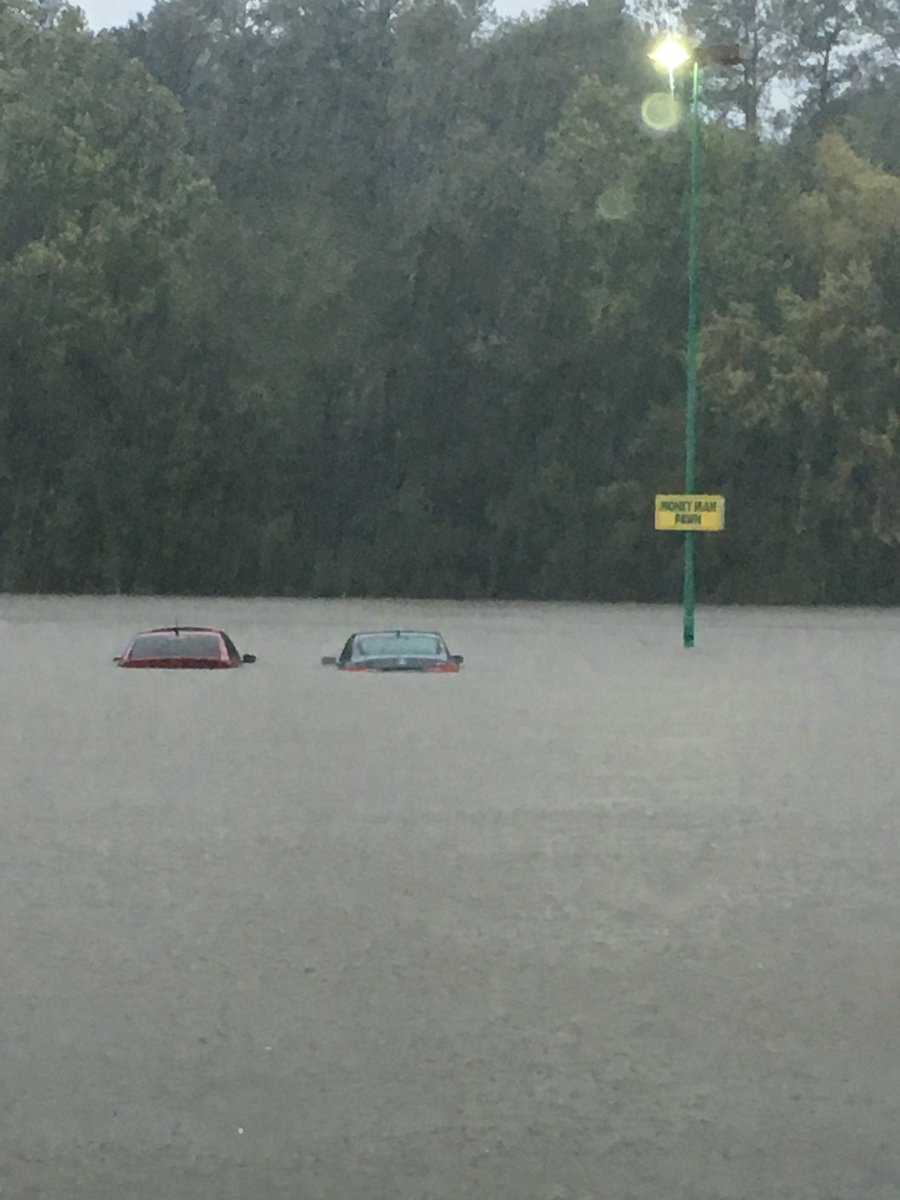
-
WATCH LIVE:
@PatMcCroryNC to address the impact#HurricaneMatthew could have on the NC coast: http://on.wsoctv.com/24hkjKs#ncwx#matthew -
Stanly Co included in a Flash Flood Warning (red), while counties in green remain in a Flash Flood Watch.
@wsoctv http://wsoctv.com/weather/interactive-radar …pic.twitter.com/mCmtK1C5L7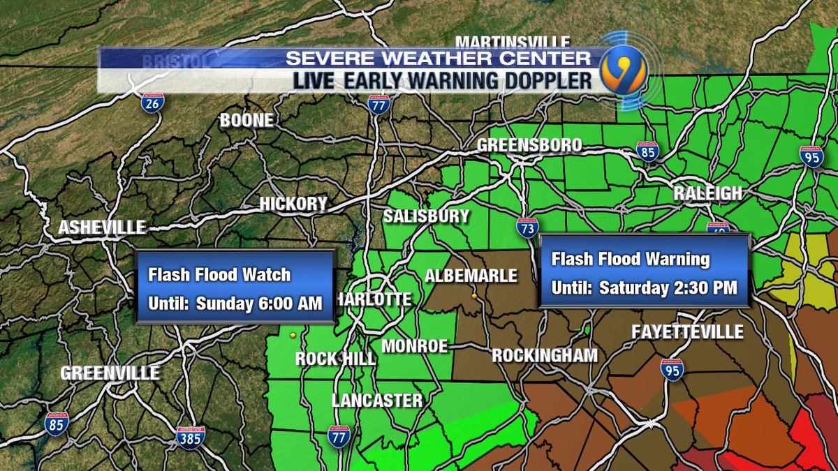
-
Chesterfield county emergency management says power crews will not send lineman out to fix lines until storm passes. It's too dangerous.
-
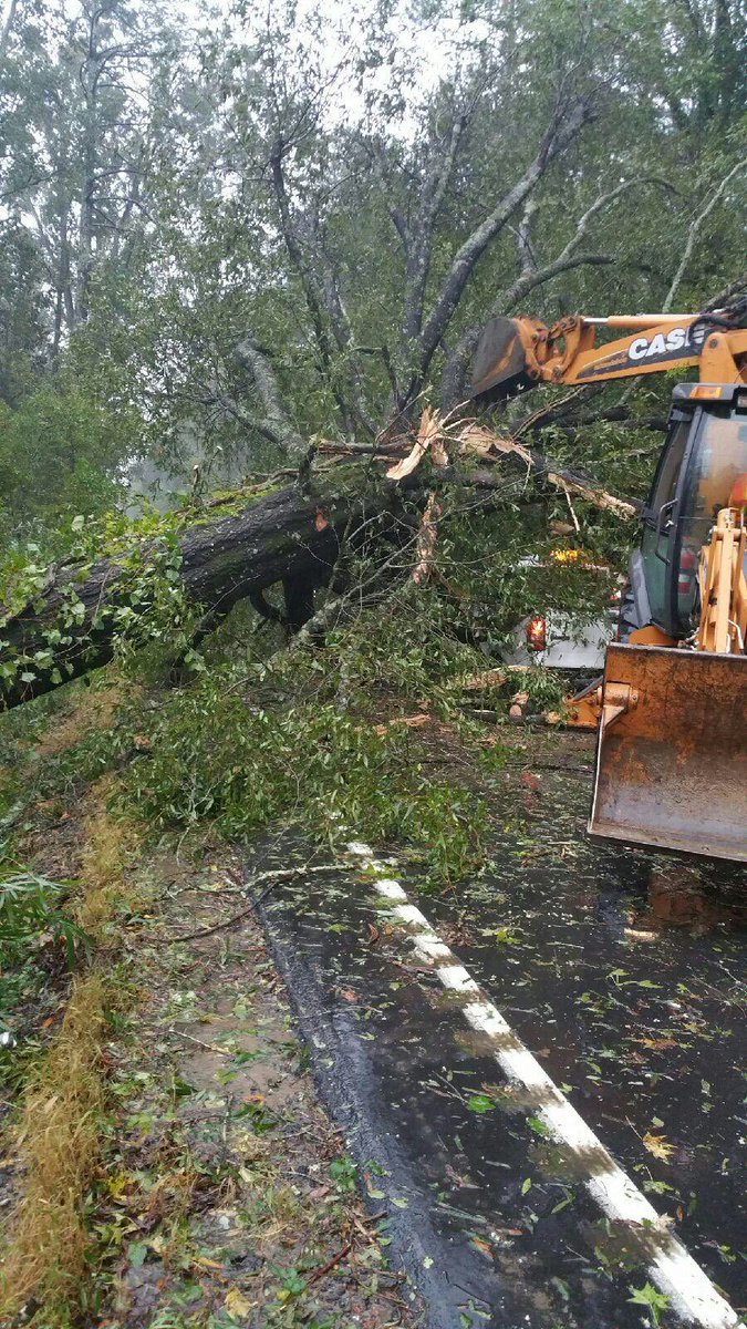
This is why we stress to STAY OFF the roads! SCDOT truck struck by falling tree while responding to call on Bluff Edpic.twitter.com/r61YIanca3
-
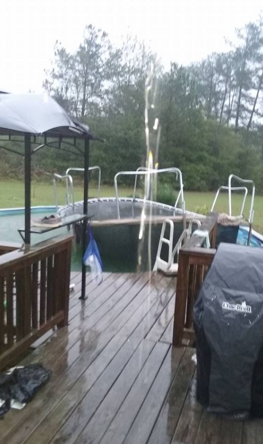
Viewer photo: High winds pushed a trampoline into a pool in Mount Croghan, SC http://on.wsoctv.com/2dI3PqA pic.twitter.com/vcl98OceFz
-
Excellent point
@nsj ! No time to let your guard down along the NC/SC coasthttps://twitter.com/nsj/status/784730043075424256 … -
EMS has suspended service county wide and we are now under CONDITION RED - bridges are not safe for travel due to high winds
#chsnewspic.twitter.com/fuCMjLXSVN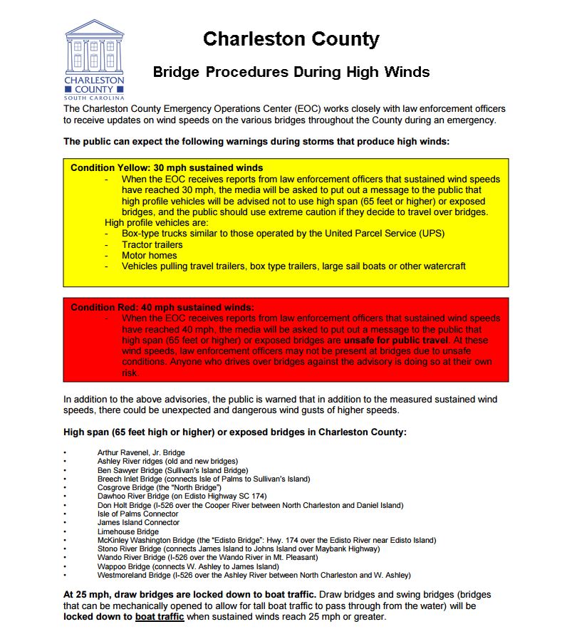
-
Chatting live on Facebook with
@kmondayWSOC9 on the latest on#Matthew. JOIN US! -> https://www.facebook.com/wsoctv/videos/1116073981762624/ … -
Flash Flood Warning has been issued for Anson, Richmond Co until 2p. RADAR: http://wsoctv.com/weather/interactive-radar …
@wsoctv#NCWX#Matthewpic.twitter.com/DHbMRAg4UN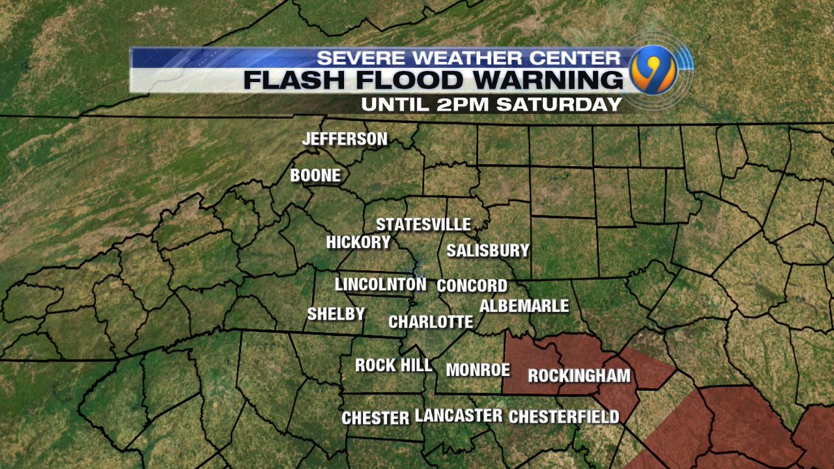
-
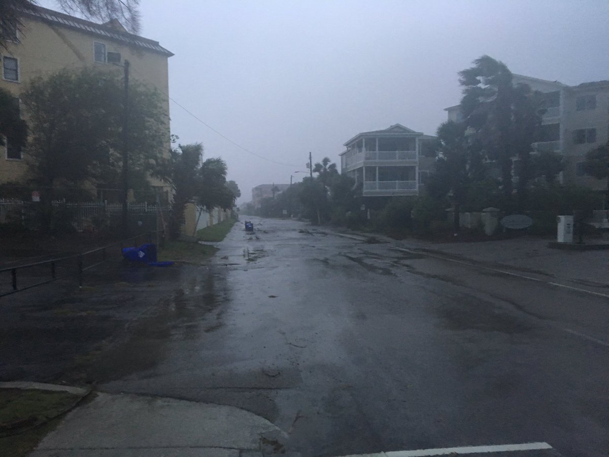
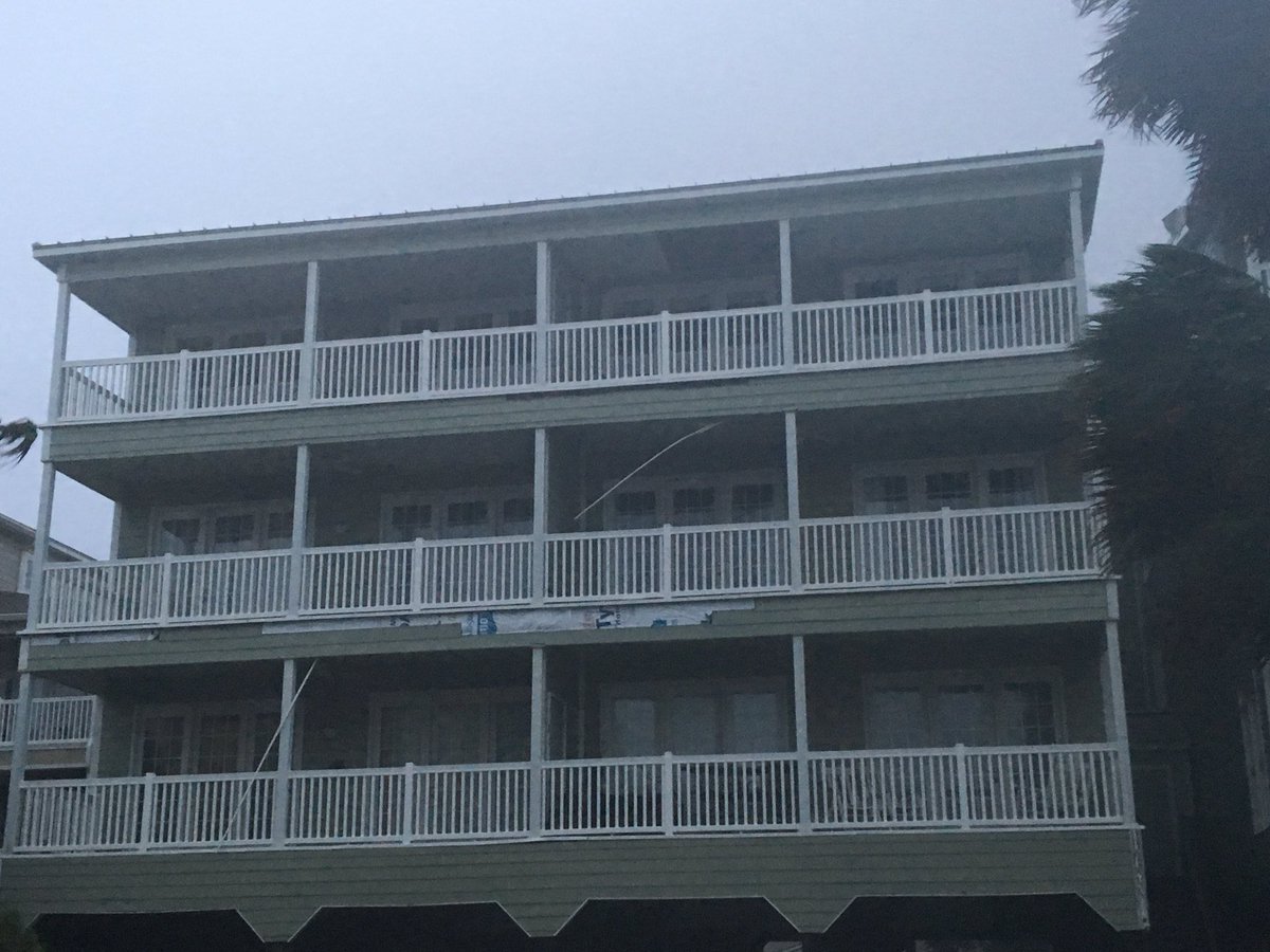
I'm seeing debris and structure damage on the streets of Folly Beach
@wsoctvpic.twitter.com/a63ghscDFV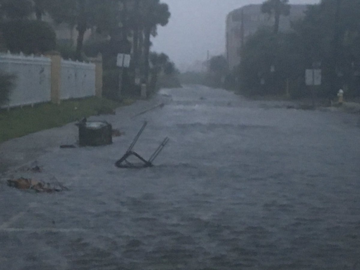

 Christine Rapp
 WSOCWeather
 WSOCTV
 Brittney Johnson
 Greg Suskin
 Trooper David SCHP
 Steve Udelson
 Charleston County
 Joe Bruno
ಲೋಡಿಂಗ್ ಸಮಯ ಸ್ವಲ್ಪ ತೆಗೆದುಕೊಳ್ಳುತ್ತಿರುವಂತೆನಿಸುತ್ತದೆ.
Twitter ಸಾಮರ್ಥ್ಯ ಅಧಿಕವಾಗಿರಬಹುದು ಅಥವಾ ಈ ಕ್ಷಣದ ತೊಂದರೆಯನ್ನು ಅನುಭವಿಸುತ್ತಿರಬಹುದು. ಮತ್ತೆ ಪ್ರಯತ್ನಿಸಿ ಅಥವಾ ಇನ್ನಷ್ಟು ಮಾಹಿತಿಗೆ Twitter ಸ್ಥಿತಿ ಗೆ ಭೇಟಿ ನೀಡಿ.