Saba
From Wikipedia, the free encyclopedia
| Saba | ||||||
|---|---|---|---|---|---|---|
| — Public body of the Netherlands — | ||||||
|
||||||
| Motto: "Remis Velisque" (Latin) "With oars and sails" (English) |
||||||
| Anthem: "Saba you rise from the ocean" |
||||||
 |
||||||
 Map showing location of Saba relative to St. Eustatius and St. Martin.
|
||||||
| Country | Netherlands | |||||
| Capital (and largest city) |
The Bottom 17°38′N 63°15′W / 17.633°N 63.25°W |
|||||
| Official language(s) | Dutch | |||||
| Recognised regional languages | English[1] | |||||
| Government | See Politics of the Netherlands | |||||
| - | Monarch | Willem-Alexander | ||||
| - | Lt. Governor | Jonathan Johnson | ||||
| Area | ||||||
| - | Total | 13 km2 5 sq mi |
||||
| Population | ||||||
| - | 2012[2] census | 1,971 | ||||
| - | Density | 140/km2 362.6/sq mi |
||||
| Currency | US dollar (USD) |
|||||
| Time zone | AST (UTC−4) | |||||
| Internet TLD | .an,[3] .nl | |||||
| Calling code | +599-4 | |||||


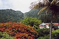
Saba (spoken as "Sah-ba") is the smallest island of the Caribbean Netherlands and the former Netherlands Antilles. It is a special municipality (public body) of the Netherlands. It lies at 17°38′N 63°14′W. It is mostly made up of Mount Scenery (877 m), the highest point of the Kingdom of the Netherlands. Scenery is a dormant volcano.
Saba has a land area of 13 km² (5 sq. miles). At the 2001 Netherlands Antilles census, 1,349 people lived there. In 2004, about 1,424 people lived there.
Gallery[change | change source]
-

Hawksbill Turtle
-

Saba's airport
-

-


References[change | change source]
- ↑ English can be used in relations with the government
"Invoeringswet openbare lichamen Bonaire, Sint Eustatius en Saba" (in Dutch). wetten.nl. http://wetten.overheid.nl/BWBR0028063/tekst_bevat_taal%2Bin%2Bhet%2Bbestuurlijk%2Bverkeer/geldigheidsdatum_14-10-2012. Retrieved 2012-10-14. - ↑ "Bevolkingsontwikkeling Caribisch Nedoerland; geboorte, sterfte, migratie" (in Dutch). Central Bureau of Statistics. 2012. http://statline.cbs.nl/StatWeb/publication/?DM=SLNL&PA=80539ned&D1=0-1,9-10&D2=a&D3=a&HDR=T&STB=G1,G2&CHARTTYPE=1&VW=T. Retrieved 2012-12-13.
- ↑ The domain for the Netherlands Antilles has remained active after its dissolution. The ISO 3166-1 alpha-2 code BQ was established for the entity "Bonaire, Sint Eustatius, Saba". ("ISO 3166-1 decoding table". International Organization for Standardization. http://www.iso.org/iso/support/country_codes/iso_3166_code_lists/iso-3166-1_decoding_table.htm#BQ. Retrieved 2010-12-17.) An Internet ccTLD has however not been established by the IANA, and it is unknown if it will be opened for registration.
Other websites[change | change source]
- Saba's Tourist Bureau homepage
- Saba Conservation Foundation's homepage
- Saba Ferry Dawn II
- Saba (N.A.): Bos en nationale parken. 54pp.
- Saba University School of Medicine
| Wikimedia Commons has media related to: Saba |